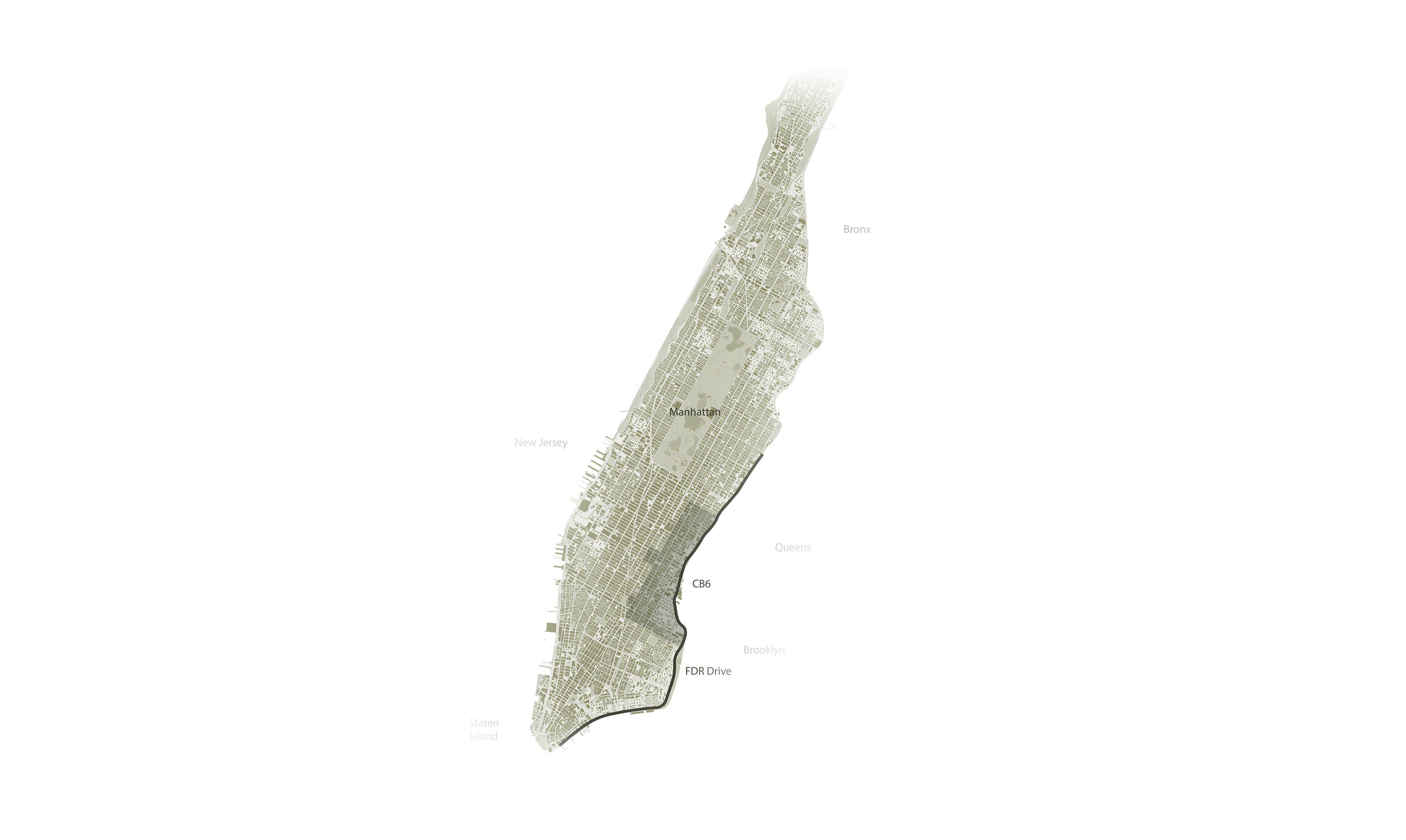
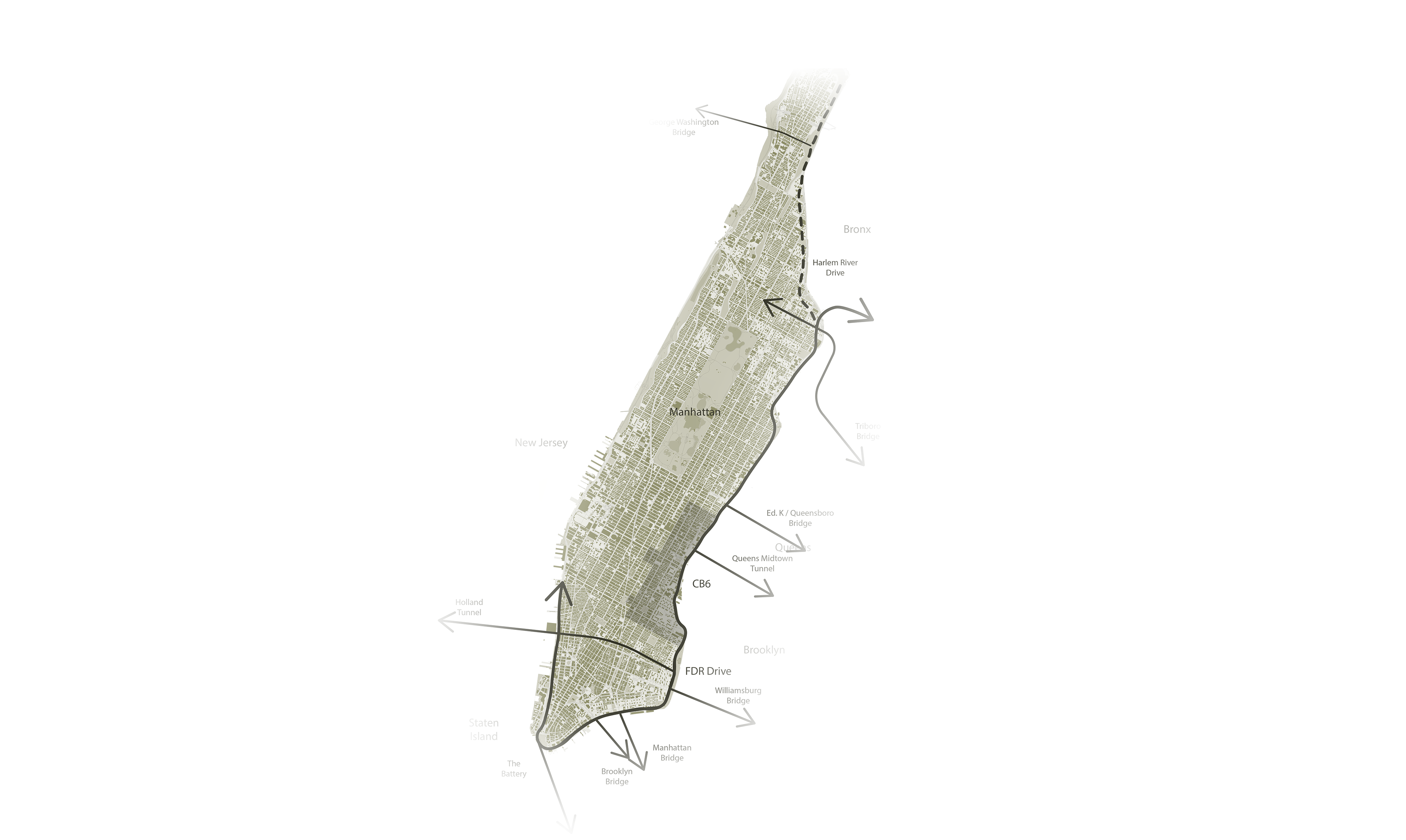
This project explores the profound impacts of FDR Drive on health, equity, and climate resilience. Adjacent communities, predominantly low-income, face heightened exposure to air pollution and the urban heat island effect, contributing to alarming disparities in respiratory and heat-related illnesses. The roadway itself, spanning over 9.5 miles along Manhattan’s eastern edge, is increasingly threatened by climate change.
Hurricane Sandy’s devastation underscored the region’s susceptibility, resulting in $19 billion in damages citywide and exposing glaring infrastructural deficiencies. Key recommendations include the transformation of select lanes into green, walkable pathways, enhanced public transit via Bus Rapid Transit (BRT), the incorporation of congestion pricing mechanisms, and retrofitting social housing to withstand climate impacts.
Furthermore, this redesign of the road envisions a cohesive, community-driven approach to urban planning. By creating accessible parks and recreational areas, increasing transit accessibility, and establishing flood-resistant housing solutions, this policy fosters inclusivity and resilience. Emphasis is placed on integrating of LEED certification in housing projects and relocating infrastructure in flood-prone areas.
Health Costs: Communities adjacent to the FDR Drive experience 30% higher asthma rates due to vehicle emissions (According to NYC Department of Health, in 2021), contributing to New York City’s $3.3 billion annual burden from pollution-related illnesses (American Public Health Association, 2018). Health disparities are further exacerbated by urban heat islands, which increase the risk of heat-related illnesses by 20% in affected areas (According to NYC Department of Environmental Protection, in 2019).
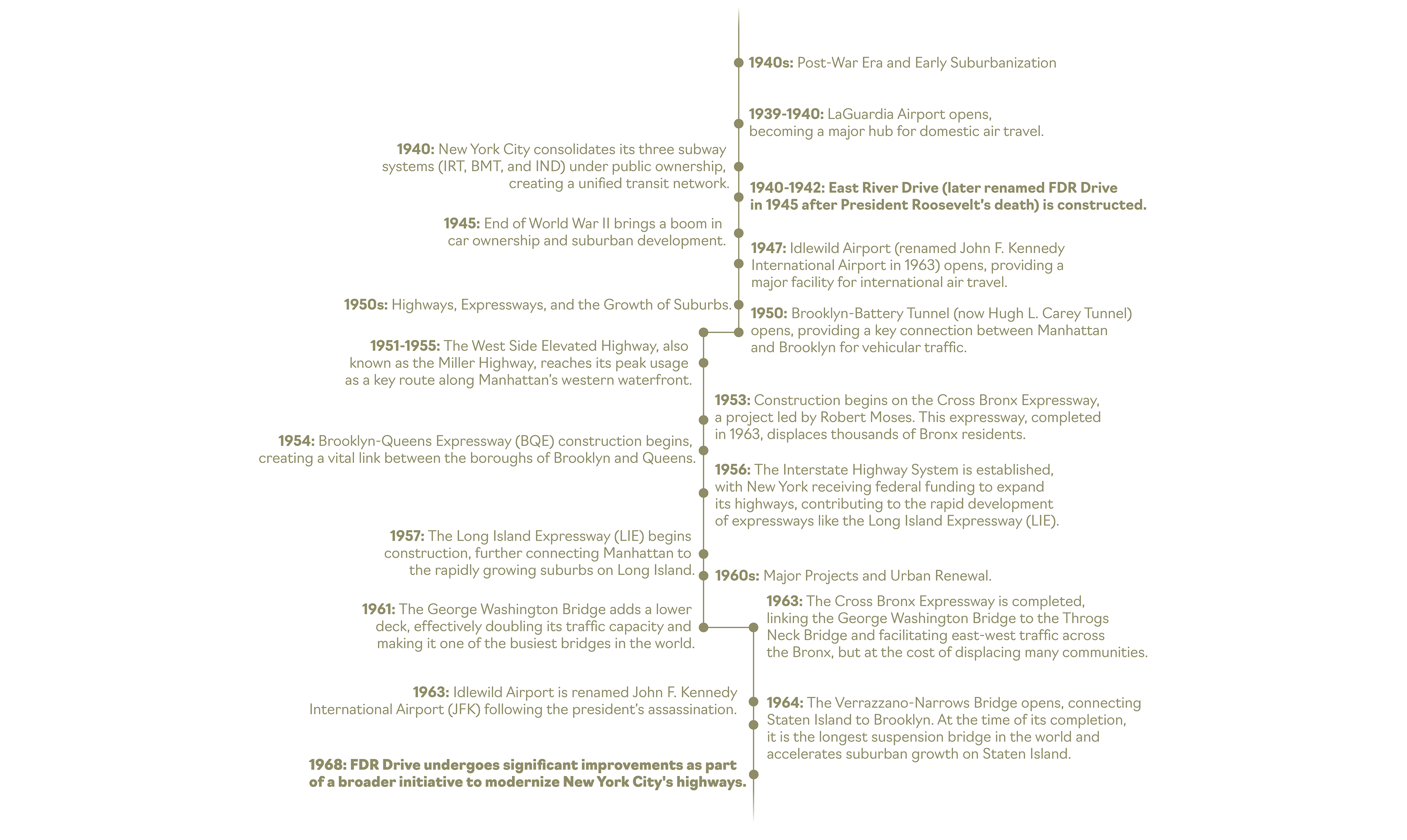
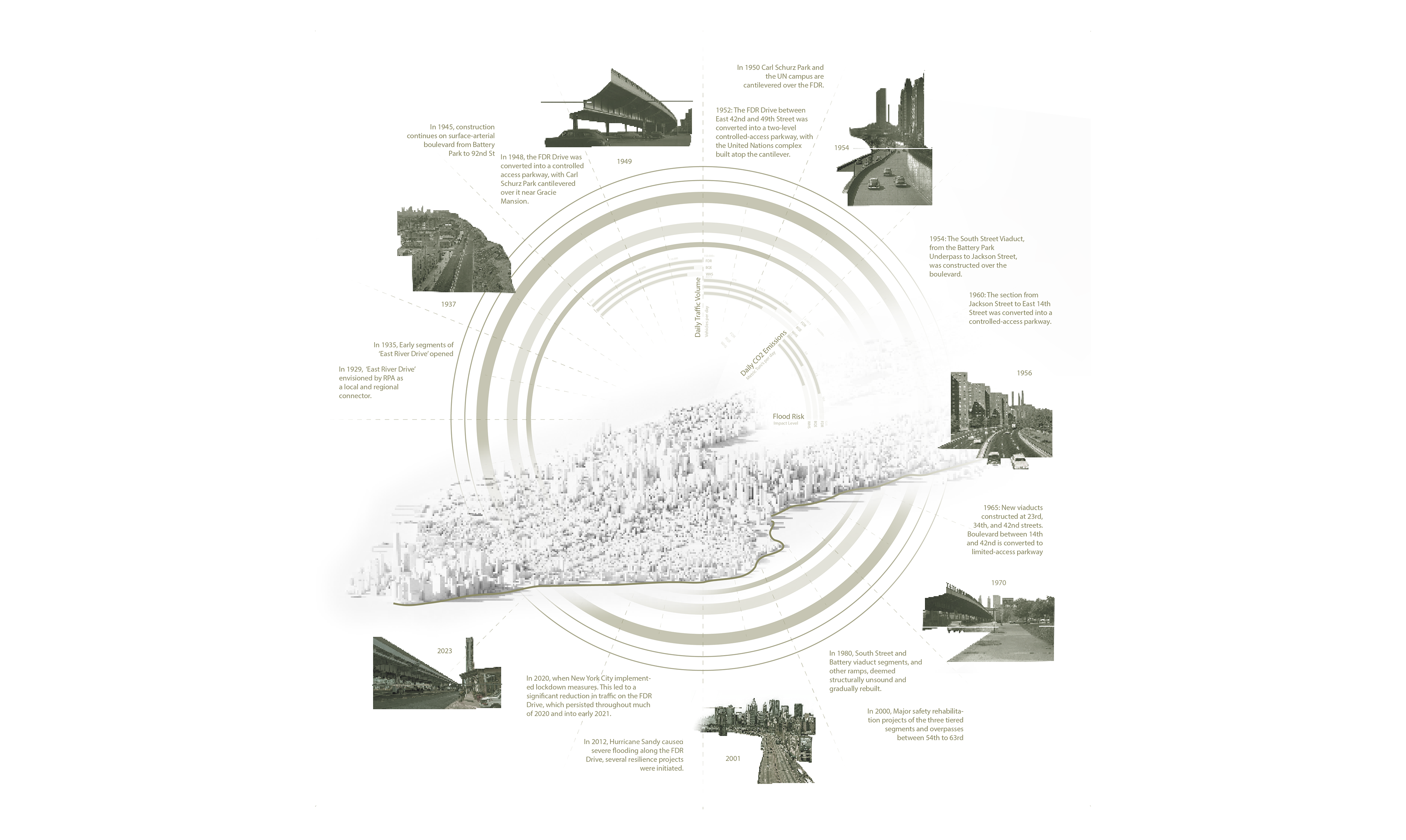
FDR Drive Timeline
Residents in these areas face heightened risks of heat-related illnesses, worsened by limited access to green spaces and cooling infrastructure, underscoring the urgent need for equitable, climate-resilient interventions.
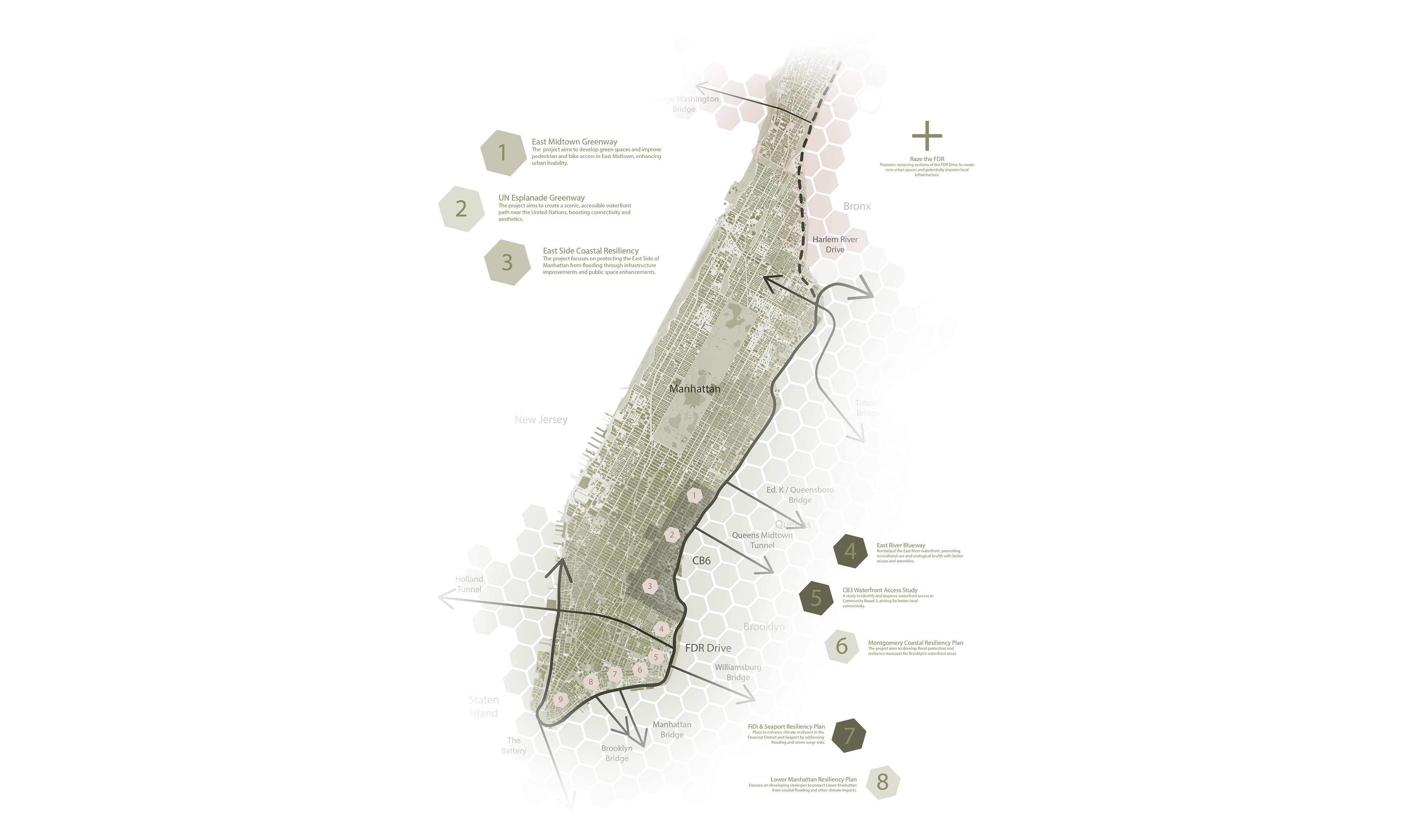
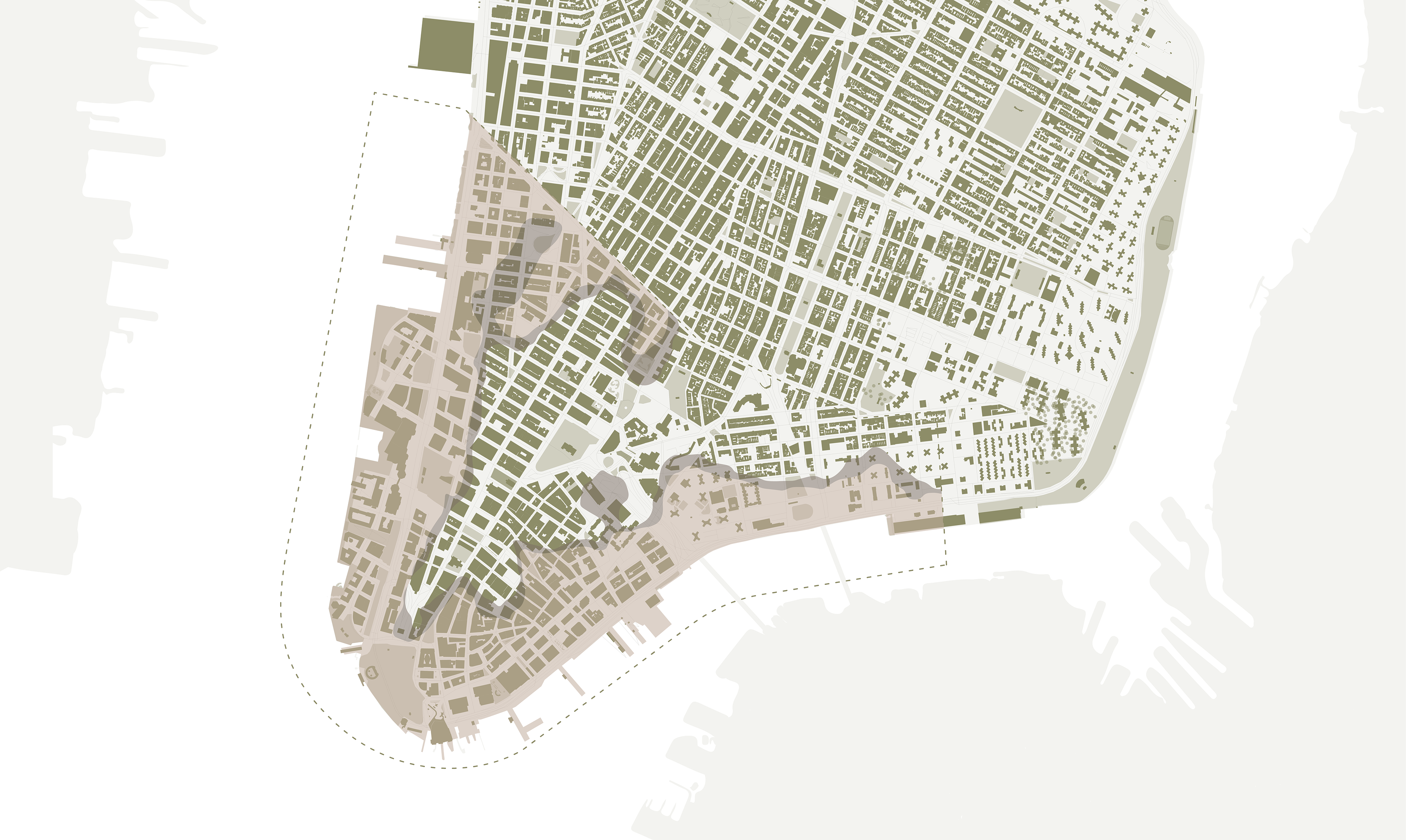
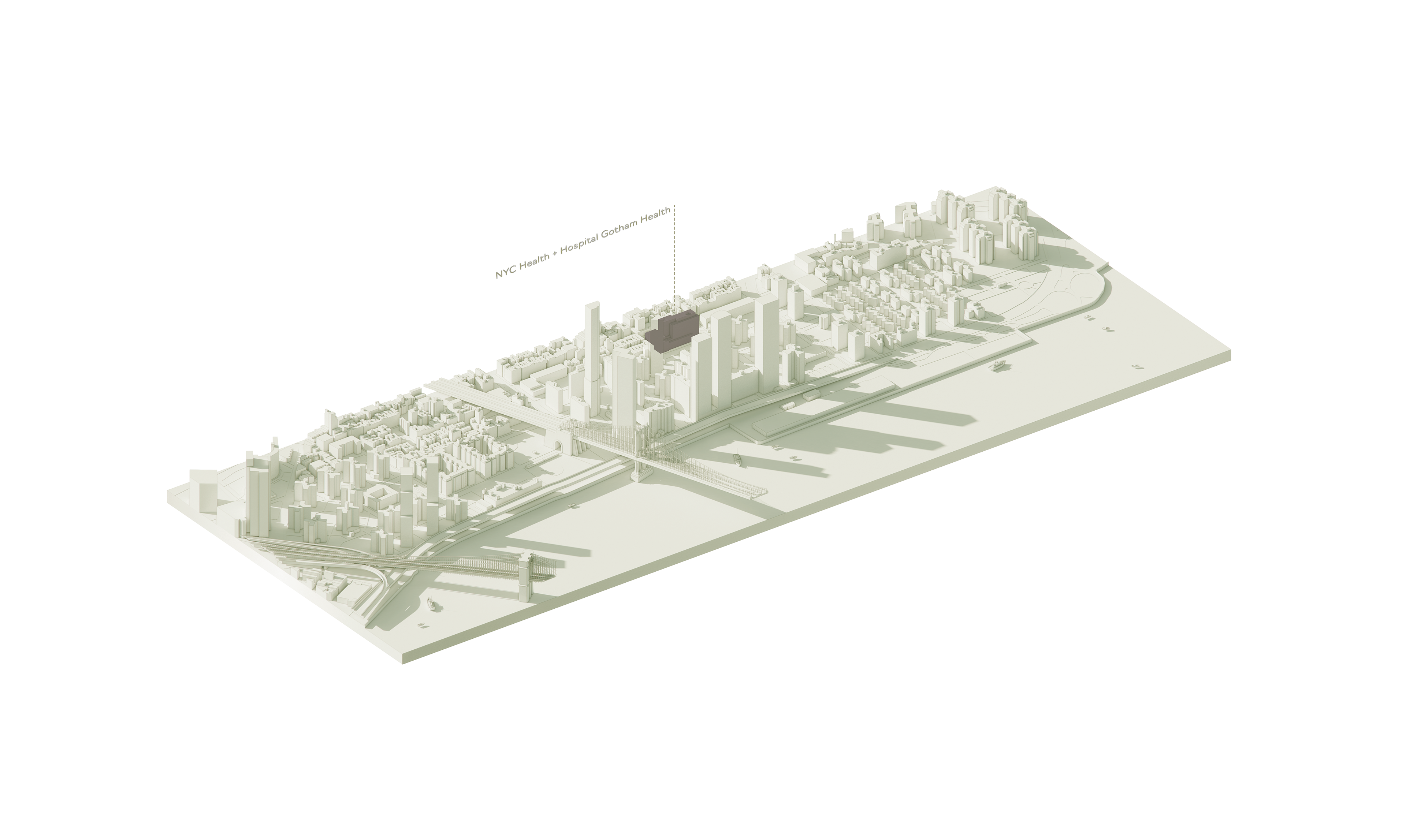
Current Plans for Downtown and Midtown Manhattan
Additionally, while the city has committed to addressing urban heat islands through various planning frameworks (such as PlaNYC), the lack of substantial investments in green infrastructure in these areas has left large portions of the city without access to cooling and green accessible spaces. These gaps in policy implementation and infrastructure exacerbate existing health disparities, illustrating how current urban planning and policy frameworks have failed to adequately address or mitigate the compounded risks faced by these communities.
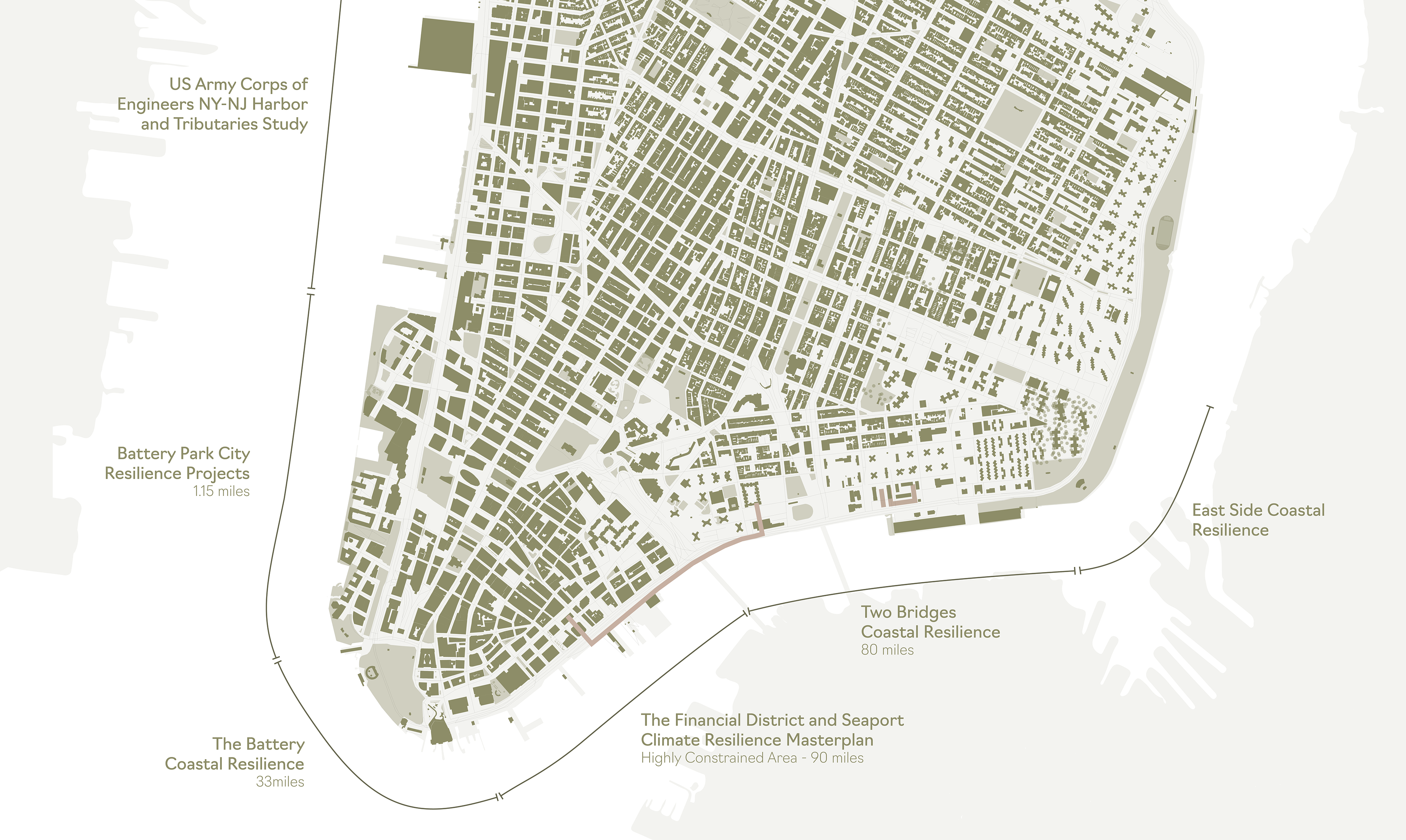
Future Flood Risks in Downtown Manhattan: 2050 & 2100 Projections
Economic Inequities and Lack of Inclusive Planning: Low-income communities near major infrastructures, such as the FDR Drive, bear the brunt of environmental injustices. The lack of green accessible infrastructure and tree canopy coverage worsens air pollution and limits cooling during heatwaves, leading to a 20% higher risk of heat-related illnesses (According to NYC Department of Environmental Protection, in 2019).
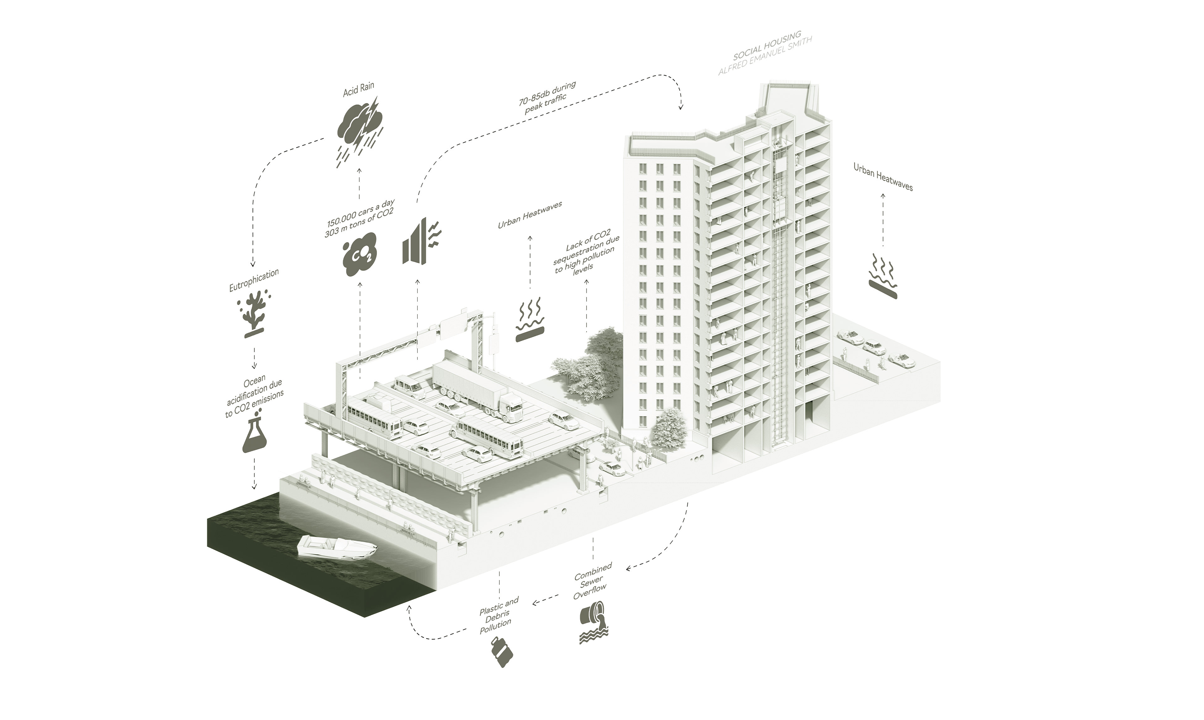
Despite climate adaptation policies like PlaNYC, implementation often overlooks these vulnerable neighborhoods, leaving them exposed to compounding health and environmental risks. Economic inequities in urban development arise from uneven resource allocation and exclusionary planning practices. For instance, only 40% of residents in areas like the Lower East Side have access to parks within a 10-min. walk, compared to 75% in affluent communities (According to Regional Plan Association, in 2020).
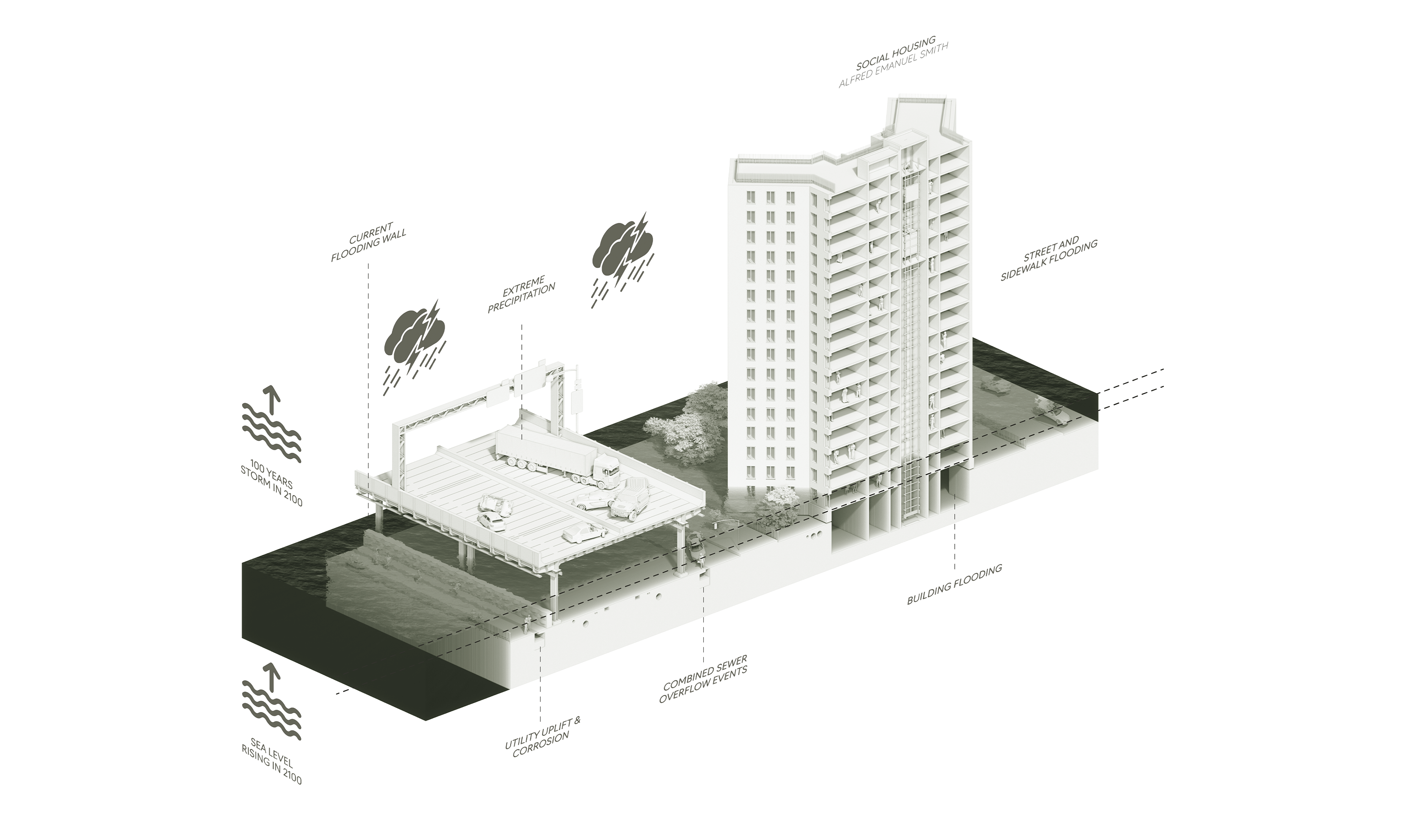
New York City climate plans, like the Lower Manhattan Coastal Resiliency Plan, emphasize flood barriers but overlook infrastructure such as the FDR Drive and exclude NYCHA retrofits, increasing displacement risks. By 2050, flooding could affect 165,000 residents (NYC Department of City Planning, 2020). Hurricane Sandy flooded 60+ NYCHA buildings, displacing 17,000 and causing $1B in damages (NYCHA, 2013; FEMA, 2013). Projections show 10,000 Lower East Side units facing annual flooding and $4B in damages by 2050 (NYC DEP, 2019), disproportionately harming low-income households.
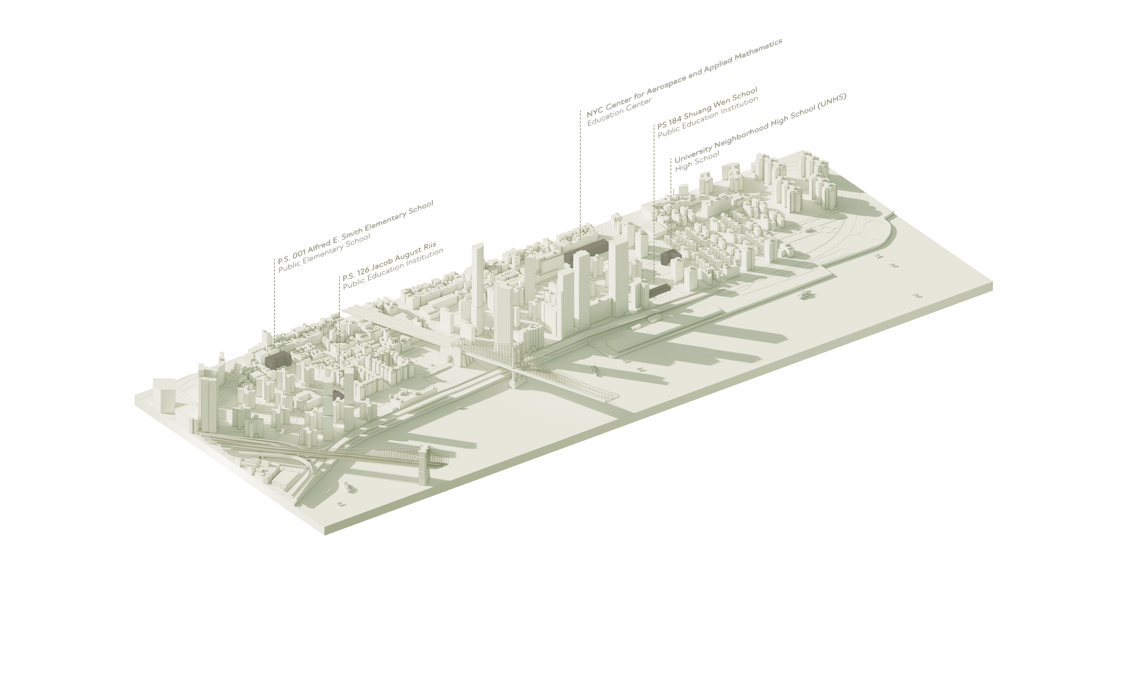
Educational Buildings
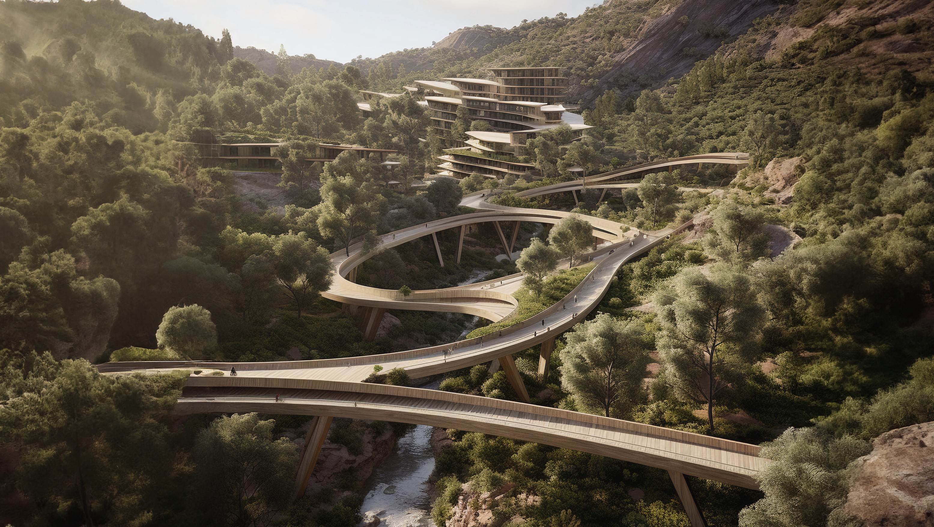
The integration of green infrastructure and walkable pathways is a fundamental component of this redesign. By converting two of the six lanes on the FDR Drive into pedestrian-friendly spaces during non-peak hours, the area will become more accessible to the community.
Healthcare Buildings
These pathways will feature trees and bioswales to reduce heat, noise, and air pollution, creating a healthier environment for the local population. Particular attention will be given to underserved areas, such as the Lower East Side, where public housing residents currently lack sufficient access to green recreational spaces. This transformation is anticipated to improve community well-being and reduce the urban heat island effect.
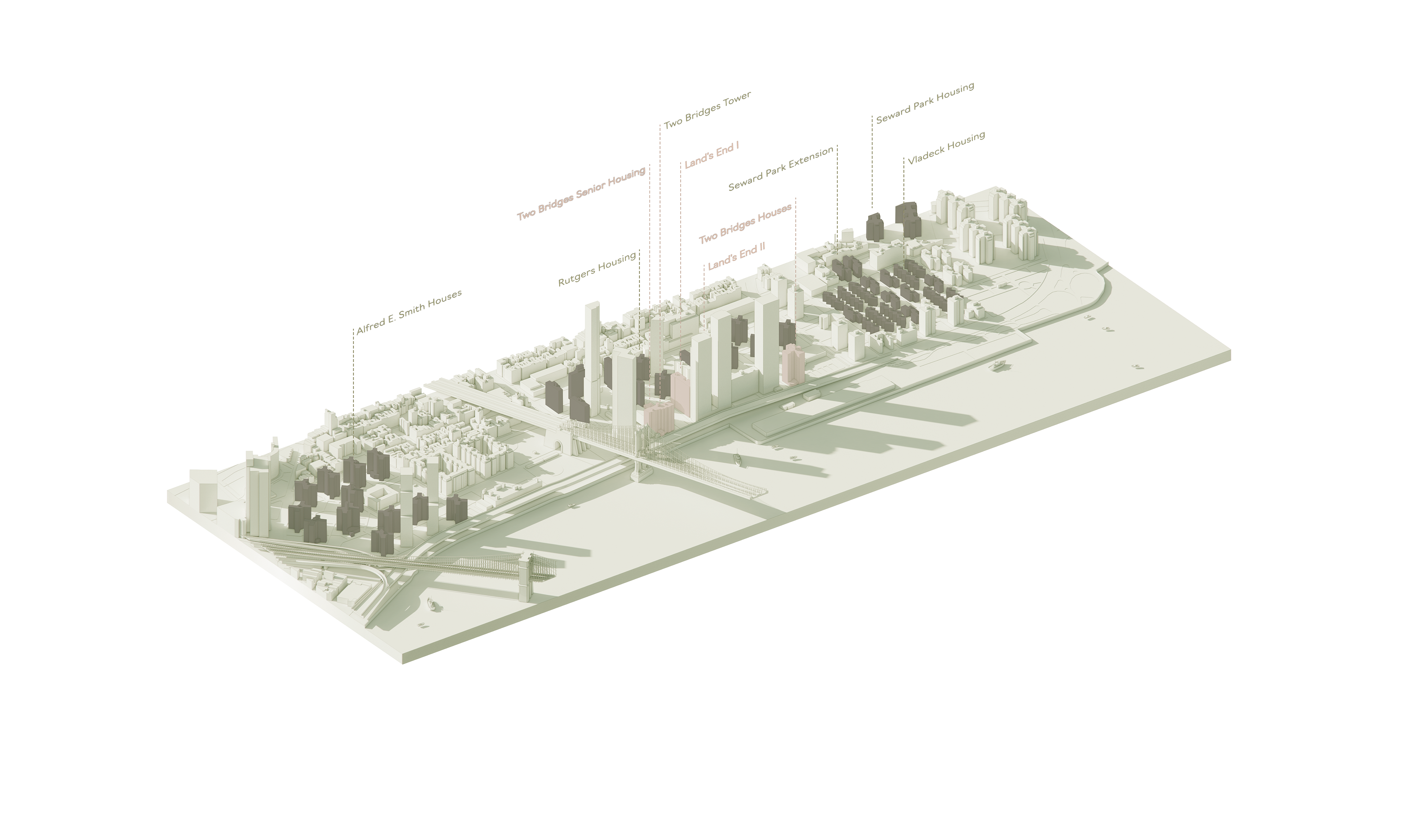
NYCHA Housing X Private Social Housing
In addition to enhancing walkability, the proposed strategy emphasizes climate-resilient retrofits for the roadway. This includes the installation of permeable pavements and modular flood barriers, which will safeguard the infrastructure against rising sea levels and extreme weather events. Cooling technologies, such as reflective materials, will also be implemented to mitigate heat-related risks. T
Current Building Developments

These retrofits will ensure the long-term functionality of the FDR Drive while protecting the vulnerable populations who rely on it.To reduce emissions and promote sustainable transit options, the introduction of Bus Rapid Transit (BRT) systems and car-free zones is also proposed. Dedicated BRT lanes will be established, facilitating efficient, electric bus routes that connect key areas along the drive. These measures aim to decrease reliance on private vehicles, congestion, and provide transit for underserved communities.
Another major policy proposal is the extension of congestion pricing to the FDR Drive, discouraging unnecessary car trips while generating revenue for public transit upgrades. To balance equity, exemptions and tiered discounts will be applied for electric vehicles and low-income residents, ensuring the burden does not fall disproportionately on vulnerable populations. Revenue from this measure will support Bus Rapid Transit (BRT) expansion and other sustainable mobility initiatives, reducing car dependency and improving access to efficient, affordable transportation. The redesign also introduces a housing strategy focused on climate resilience and sustainability.
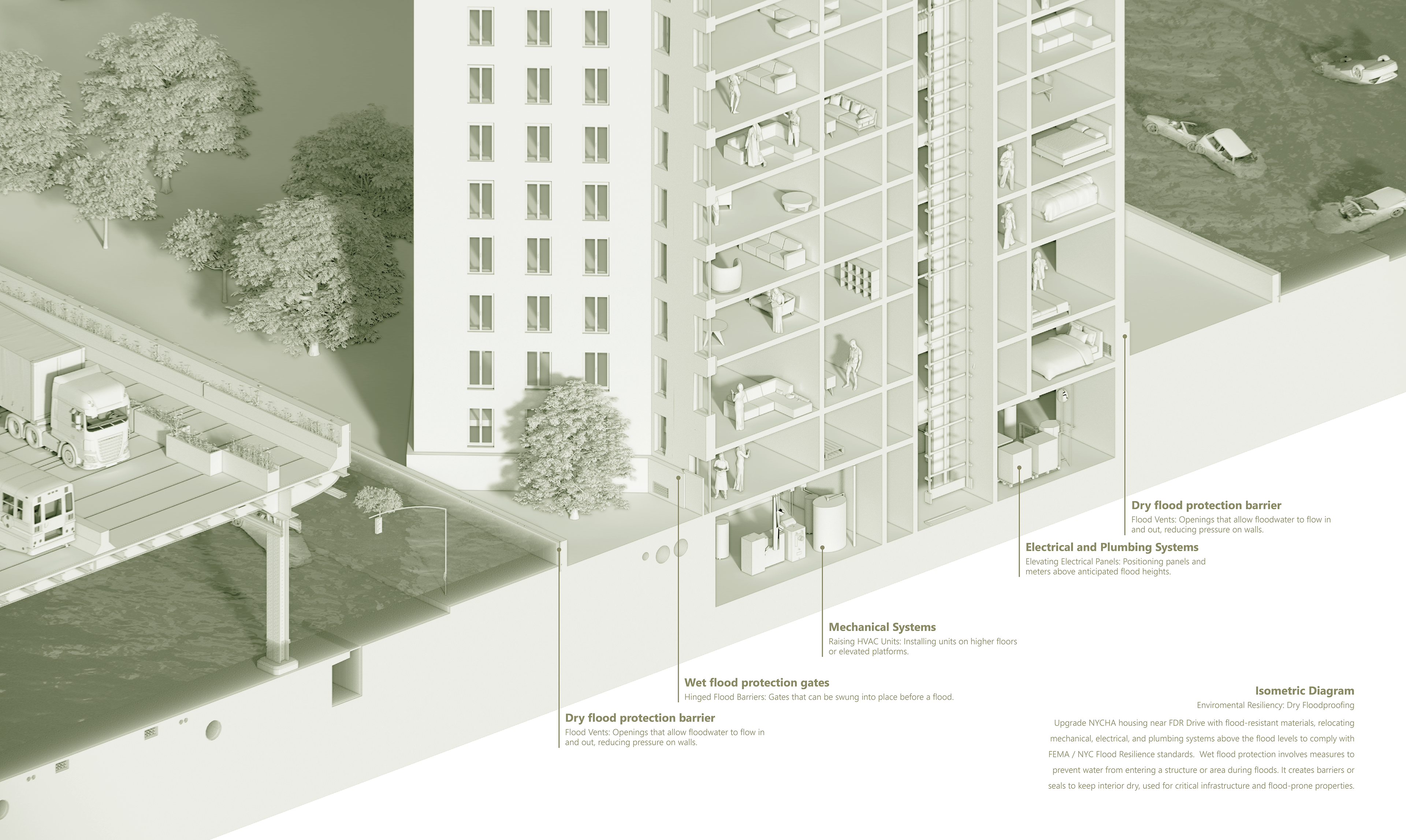
Public housing near the Drive, particularly NYCHA buildings, will be retrofitted with flood-resistant materials, elevated infrastructure, and energy-efficient cooling systems. New housing projects will be required to achieve LEED certification, ensuring future developments meet strict resilience and sustainability standards. Together, these investments aim to protect low-income communities from climate-related displacement while addressing equity concerns.